| An important aspect governing the movement of water and chemicals
in soil is land use. Characterization of the landuse of the conterminous
United States was determined by the U.S. Geological Survey (USGS), EROS Data
Center (EDC), and the Center for Advanced Land Management Information
Technologies at the University of Nebraska in 1990. This spatial data set
of vegetation cover was considered a prototype at a 1-km resolution and developed
for global environmental research. Generation of the data set was from the
National Oceanic and Atmospheric Administration Advanced Very High Resolution
Radiometer (AVHRR) satellite images with post-classification refinement based
on other digital earth science data sets, including topography, climate,
soils, and ecoregions.
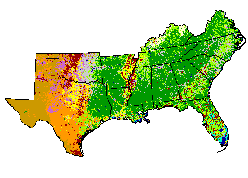
The AVHRR data were reclassed into 12 different categories by grouping similar
categories of land use and land cover. There were four initial categories
of Agricultural (primarily cropland), Forest, Range, and Barren with eight
additional categories. The other eight categories were various permutations
or combinations of the initial categories. For example, water and Marshes
were combined into a single category. Urban areas were not represented on
the AVHRR data so this category was not interpreted. These data were set
to a 1 kilometer resolution matching that of the AVHRR data. |