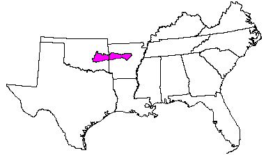

Land use: About 57 percent of this MLRA is forested. About one-third of the wooded area is federally owned, and most of the other two-thirds consists of farm woodlots. Twenty-six percent of the MLRA is grazed land, 11 percent is cropland, and 6 percent is used for miscellaneous purposes. Most of the cropland is in the less sloping valleys areas, but some is on flat mountain tops. Small grains and hay are the major crops. Soybeans are an important crop on the Arkansas River bottom land. Orchards, vineyards, and vegetable crops are important locally. Pastures on the bottom land of small streams and throughout cleared parts of the uplands consist of a mixture of tame and native grasses and legumes.
Elevation and topography: Elevation ranges from 100 m on the lowest valley floors to 900 m on some mountain tops. These ridges and valleys are underlain by slightly folded to level beds of sandstone and shale. Ridge slopes are steep; most crests are narrow and rolling, but some are broad and flat. The intervening valleys are broad and smooth. Local relief is in meters in the valleys and on the flat ridgetops. The ridges and mountains rise sharply tens of meters above adjacent valleys.
Climate: Average annual precipitation - 1,125 to 1,275 mm. Maximum precipitation is in spring and in autumn. Average annual temperature - 16 to 17 C. Average freeze-free period - 200 to 240 days.
Water: The moderate precipitation generally is adequate for crops and pasture. On the uplands, water for domestic use comes mainly from shallow wells and water for livestock from small ponds on individual farms. In the valleys, springs, shallow wells, small ponds, and perennial streams provide water for most uses. Deep wells yield large quantities of hard water, but in areas of shale bedrock ground water is scarce.
Soils: The major soils are Udults. They are stony and nonstony and medium textured. These soils have a thermic temperature regime, an udic moisture regime, and siliceous or mixed mineralogy. Well drained, shallow and moderately deep Hapludults (Mountainburg and Linker series) are on ridgetops, benches, and upper slopes. Well drained, deep Hapludults (Enders series) and Paleudults (Nella series) are on middle and lower slopes and in concave interledge positions. Fragiudults (Leadvale, Taft, and Cane series) are in the valleys. Udifluvents (Roxana series), Udipsamments (Crevasse series), Haplaquolls (Roellen series), and Hapludalfs (Gallion series) are minor soils along the Arkansas River, and Dystrochrepts (Barling series) and Hapludults (Spadra and Pickwick series) are minor soils on terraces along smaller streams.
Potential natural vegetation: This area supports hardwood forests. The primary overstory species are red oak, white oak, and hickory. Shortleaf pine is important on disturbed sites, on shallow soils, and on sites having a south or west aspect. Big bluestem, switchgrass, indiangrass, and little bluestem are important understory species under medium to open forest canopy. Broadleaf uniola, longleaf uniola, wildryes, and low panicums are important species under heavy canopy.
(From "Land Resource Regions and Major Land Resource Areas of the United States". United States Department of Agriculture Soil Conservation Service Handbook 296. Dec. 1981. page 86.)