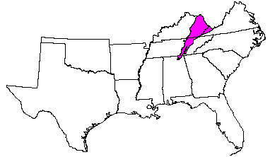

Land use: Most of this area consists of small and medium-size farms. An extensive acreage in Kentucky is in the Daniel Boone National Forest, and some large tracts are owned by coal and timber companies. Urbanization is minor. About 80 percent of the area is forests of mostly mixed hardwoods. Lumber is an important product. About 8 percent of the area is cropland. Corn, hay, and tobacco are the major crops. About 8 percent is pasture used mostly for beef cattle. Stabilizing strip-mined areas is a major concern of management.
Elevation and topography: Elevation ranges from 200 m on the Ohio River flood plain to about 300 m on nearby ridgetops, gradually rising to near the Virginia-Kentucky border, where local flood plains are about 500 m, and higher mountains are about 1,200 m. The highly dissected landscape is largely a series of long steep side slopes between narrow ridgetops or crests and narrow stream flood plains.
Climate: Average annual precipitation-1,175 mm; about 525 mm falls during the growing season. The variable snowfall averages about 50 cm. Average annual temperature-13 C. Average freeze-free period -175 days.
Water: Water is abundant in most of the area. In most years precipitation is adequate for crops, but in some years yields are reduced by droughts. The large streams and constructed lakes supply most of the urban water. Farm ponds, wells, and cisterns are sources of water in rural communities. Large quantities of ground water are available in the valley of the Ohio River and its major tributaries, but only small quantities are locally available in the rest of the area.
Soil: Most of the soils are Udults. They are medium textured to fine textured. These soils have a mesic temperature regime, an udic moisture regime, and mixed or siliceous mineralogy. Hapludults (Shelocta, Jefferson, Clymer, Gilpin Latham, Lily, and Hartsells series) and Fragiudults (Tilsit series) on side slopes and ridges formed in loamy hillside colluvium or residuum. Medium textured, very gravelly Dystrochrepts (Dekalb, Berks, and Calvin series) are on upper side slopes and ridges. Loamy Dystrochrepts (Pope series) and Fluvaquents (Bonnie series) are on flood plains. Loamy Hapludults (Allegheny series) and Fragiudults (Monongahela series) are on stream terraces.
Potential natural vegetation: This area supports a variety of woody
and herbaceous plant communities. Mixed hardwood forest vegetation is in
coves and on north- and east-facing slopes. Yellow-poplar, beech, black walnut,
basswood, red and white oaks, hemlock, and buckeye are among the 20 or more
tree species. Oak-hickory communities, shortleaf pine, pitch pine, and Virginia
pine are on ridges and on south- and west-facing slopes. Willows, sycamore,
sweetgum, and river birch grow on flood plains.
(From "Land Resource Regions and Major Land Resource Areas of the United
States". United States Department of Agriculture Soil Conservation Service
Handbook 296. Dec. 1981. page 90.)