Land use: Most of this area consists of small and medium-size farms. About 40 percent is forests of mixed hardwoods, most of which, except for a few wooded mountain ridges, are in small farm woodlots. A large acreage in Virginia is in the George Washington and Thomas Jefferson National Forests. Hay, pasture, and some grain for beef cattle and dairy cattle are the principal crops. Burley tobacco is the important cash crop in the southern two-thirds of the area (excluding Georgia). Some cotton is grown south of Chattanooga. Small acreages of corn and soybeans are grown throughout the area, mainly on narrow strips of bottom land and on adjacent low terraces.
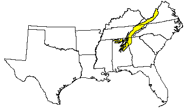
Elevation and topography: Elevation ranges from 200 m near the southern end to more than 600 m in Central Virginia. Some isolated linear mountain ridges rise to nearly 1,500 m above sea level. The area is highly diversified. It consists of many parallel ridges, narrow intervening valleys, and large bodies of low, irregular hills. The ridges and valleys often have a difference in elevation of 200 m. The western side of the area is dominantly hilly to very steep and is rougher and much steeper than the eastern side, much of which is rolling and hilly.
Climate: Average annual precipitation-925 to 1,400 mm. Maximum precipitation is in midwinter and in midsummer, and the minimum is in autumn. Average annual temperature-13 to 16 C. Average freeze-free period-170 to 210 days.
Water: Precipitation generally is adequate for crops and for other needs. Short dry periods early in summer occasionally reduce crop yields. Permanent streams, originating in the mountainous regions on either side, carry water to nearly all parts of the area. Several dams, constructed by the Tennessee Valley Authority on the Tennessee River and its major tributaries, provide flood control, navigation, power production, and recreation. Shallow wells, supplemented locally by springs and ponds, are important sources of water for farmstead use.
Soils: Most of the soils are Udults and, to a lesser extent, Ochrepts. They have an udic moisture regime and a thermic or mesic temperature regime. The soils dominantly are well drained, strongly acid, and highly leached and have a clay-enriched subsoil. They range from shallow on the sandstone and shale ridges to very deep in the valleys and on the large limestone formations. Paleudults (Dunmore, Decatur, Dewey, Frederick, and Fullerton series, commonly cherty) are on the numerous and extensive areas underlain by limestone that traverse the region in a southwest- northeast direction. Hapludults (Sequoia series) are dominant in the valleys underlain by acid shale. Steep, shallow to moderately deep, shaly and stony Dystrochrepts (Muskingum, Weikert, Wallen, Litz, Lehew, and Calvin series) are on the sides of the steep ridges. Shallow, shaly Eutrochrepts (Dandridge and Whitesburg series) are on the shale formation that extends along the eastern side of the area. Hapludolls (Huntington and Staser series) and Eutrochrepts (Chagrin, Hamblen, Lobdell, Sullivan, and Lindside series) occupy the narrow strips of bottom land. The proportion of poorly drained soils, mainly Aquepts and Aquults, is very small.
Potential natural vegetation: This area supports hardwood or mixed
hardwood-pine forest vegetation. The deeper soils support good oak-hickory
stands. The shallower soils, mostly on southern and western slopes, support
pine or oak-pine types. Understory vegetation is also reflected by aspect.
Little bluestem is the dominant grass species.
(From "Land Resource Regions and Major Land Resource Areas of the United
States". United States Department of Agriculture Soil Conservation Service
Handbook 296. Dec. 1981. page 91 - 92.)