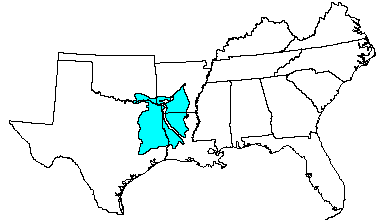

Land use: Most of this area is in farms. Between one-half and three-fourths is forest and woodland. A few large tracts are owned by large corporations and the federal government (national forests), and lumber and pulp wood production is important. Land that is cleared is used mostly for pasture and hay crops. About one-sixth is used for cropland. Common crops grown are corn, grain sorghum, oats, soybeans, peanuts, rice, and vegetable crops.
Elevation and topography: Elevation ranges from 25 to 200 m, increasing from south to north. This area is a gently to strongly sloping dissected coastal plain. Local relief is in meters.
Climate: Average annual precipitation - 1,025 to 1,350 mm, increasing from northwest to southeast. Maximum precipitation is in spring and early in summer, and the minimum is late in summer and in autumn. Average annual temperature - 16 to 20 C. Average freeze-free period - 200 to 270 days, increasing from north to south.
Water: Precipitation, perennial streams, and ground water generally provide an abundance of water. Even though summer rainfall is generally adequate, droughts are common. There is a summer moisture deficit of 50 to 150 mm. The wet soils need to be drained before they can be used for crops. A few large reservoirs on major streams provide municipal water supplies and also serve as recreation sites. Water for farm use comes from ponds and wells.
Soils: Most of the soils are Udults. They are deep, moderately coarse textured and coarse textured. These soils have a moderately coarse textured to fine textured subsoil, a thermic temperature regime, an udic moisture regime, and siliceous or mixed mineralogy. Moderately well drained Paleudults (Bowie, Felder and Malbis series), well drained Paleudults (Briley, Lilbert, Darco, Ruston, Shubuta, and Smithdale series), well drained Hapludults (Kirvin and Cuthbert series), moderately well drained Hapludults (Sacul series), moderately well drained Hapludalfs (Woodtell and Cadeville series), well drained Paleudalfs (Nacogdoches and Bernow series), well drained Hapludalfs (Kisatchie series), somewhat poorly drained Albaqualfs (Anacoco series), and somewhat excessively drained Paleudults (Eustis series) are on uplands. Fluvaquents (Mantachie, Boggy, and Nahatche series), Udifluvents (Iuka, Oklared, and Severn series), Eutrochrepts (Marietta and Redlake series), and Glossaqualfs (Guyton series) are along major streams that drain the area. Most of the soils are weathered from sandstone and shale.
Potential natural vegetation: This area supports pine-hardwood forest vegetation. Loblolly pine and shortleaf pine grow with sweetgum, southern red oak, white oak, flowering dogwood, and post oak. American beautyberry, greenbrier, hawthorns, berry vines, and others make up the woody understory. Little bluestem and pinhole bluestem are the dominant herbaceous species. Other major grasses include beaked panicum, longleaf uniola, spike uniola, and yellow indiangrass. Many species of low-growing panicums and paspalums and perennial forbs such as tickclovers, lespedezas, wildbean, and several composites contribute significantly to the total annual yield.
(From "Land Resource Regions and Major Land Resource Areas of the United States". United States Department of Agriculture Soil Conservation Service Handbook 296. Dec. 1981. page 96.)