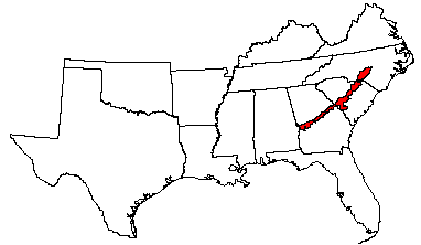

Land use: Most of this area is in farms; about one-sixth is federally owned and used for military posts and as training areas. Small acreages are used for urban development or for other purposes. About 80 percent is forest of pine and scrub oaks. Pulpwood and some lumber are the principal forest products. About 15 percent of the area is cropland, and about 5 percent is pasture. Corn and cotton are the principal crops. Most of the farms are part-time or subsistence farms.
Elevation and topography: Elevation ranges from 50 to 200 m, increasing gradually from south to north. The area is a dissected rolling to hilly upland. In many of the more dissected sites, there are stablized dunes, resulting in very irregular slopes. Local relief is mainly several meters, but a few hills are 25 to 50 m above adjacent areas.
Climate: Average annual precipitation-1,150 to 1,275 mm. Maximum precipitation is in midsummer, and the minimum is in autumn. Average annual temperature-17 to 18 C. Average freeze-free period -220 to 240 days.
Water: Precipitation, perennial streams, and ground water supply an abundance of water. The kind and amount of plant growth is severely limited by low moisture in the rapidly permeable soils that are dominant in this area.
Soils: The dominant soils are Psamments and Udults. They have a thermic temperature regime and an udic moisture regime. Deep, sandy Quartzipsamments (Lakeland and Kershaw series) and Paleudults (Blanton and Troup series) are on rolling to hilly slopes where the upper sandy strata are thick. Fragiudults (Blaney and Vaucluse series), Paleudults (Dothan and Fuquay series), and Hapludults (Pelion series) occur where the upper sand strata are thinner and underlain by more clayey materials. Psammaquents (Osier series) and Humaquepts (Rutlege series) are on very poorly drained sites along drainageways.
Potential natural vegetation: This area supports pine-oak forest vegetation. Longleaf pine is the dominant species. Turkey, blackjack, bluejack, and sand live oaks are included. Little bluestem, panicums, pineland threeawn, and associated grasses and forbs make up the ground cover vegetation.
(From "Land Resource Regions and Major Land Resource Areas of the United
States". United States Department of Agriculture Soil Conservation Service
Handbook 296. Dec. 1981. page 98-99.)