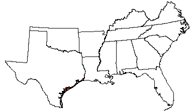
Land use: Most of this area is in ranches or is used for recreation. More than 75 percent is in native range consisting mainly of salt-tolerant plant species. A small acreage is used for bermudagrass pasture for beef cattle, rice, and grain sorghum. The remainder is mostly used for wildlife and for recreation. Deer, ducks, geese, and wild hogs are common in much of the area. Urban and recreation developments are expanding, especially along the barrier islands in the central and southern parts of the area.
Elevation and topography: Elevation ranges from sea level to about 3 m, but it is as much as 8 m on some of the dunes. The area is mostly nearly level to gently sloping coastal lowlands and island flats along the Gulf of Mexico. Parts of the area have been worked by wind, and the sandy parts have a gently undulating to irregular topography because of low mounds or dunes. Relief is mainly less than 1 m. Streams flowing into the bays have broad shallow flood plains.
Climate: Average annual precipitation-750 to about 1,400 mm. In the southwest precipitation is abundant in spring and in fall. In the northeast precipitation is evenly distributed throughout the year. Average annual temperature-21 to 23 C. Average freeze-free period-250 to 330 days.
Water: The lowest parts of the area are covered by high tides, and the remainder is periodically covered by storm tides. Rainfall is the source of water for pasture and range. A few freshwater streams and rivers flow into the area from the north, and there are many bays and small entrapments of salty waters throughout the area. There is little underground freshwater. Livestock water comes mainly from dugout ponds or shallow wells that tap thin shallow strata of freshwater. Freshwater for urban uses is piped in from outside the area.
Soils: The dominant soils are Aquents, Aqualfs, Aquolls, and Aquepts. They are mostly saline, somewhat poorly drained to poorly drained, deep, and fine textured to coarse textured. These soils have a hyperthermic and thermic temperature regime, an aquic moisture regime, and montmorillonitic, mixed, or siliceous mineralogy. Psammaquents (Mustang, Tatton, and Dianola series), Udipsamments (Galveston series), Fluvaquents (Bayucos series), and Salorthids (Segita series) are on offshore barrier islands and near shore along the bays. Nearly level to very gently sloping Haplaquolls (Harris series), Natraqualfs (Livia, Narta, and Matagorda series), Pelluderts (Francitas series), and Pellusterts (Lomalta series) are on low coastal terraces. Undulating sandy Ochraqualfs (Roemer series), Albaqualfs (Rahal series), and Paleudalfs (Portalto series) are on wind-worked plains. Haplaquolls (Aransas series), Haplaquents (Austwell series), and Fluvaquents (Placedo and Veston series) are on coastal flats and flood plains of major streams in the area.
Potential natural vegetation: This area supports grassland vegetation. The more saline soils support a plant community dominantly of gulf cordgrass and smaller amounts of little bluestem, switchgrass, seashore saltgrass, inland saltgrass, bushy sea-oxeye, marshhay cordgrass, rushes, sedges, and pickleweed. The less saline sandy soils support a plant community dominantly of little bluestem and lesser amounts of switchgrass, gulfdune paspalum, and marshhay cordgrass.
(From "Land Resource Regions and Major Land Resource Areas of the United
States". United States Department of Agriculture Soil Conservation Service
Handbook 296. Dec. 1981. page 109 - 110.)