Land use: About 60 percent of this area is rangeland, and 35 percent is cropland. The rest of the area is urban land, woodland, or pasture. Nearly all the area is in farms or ranches. Most rangeland is in the west, but some is throughout the area. Ranges and pastures are grazed mainly by beef cattle. Winter wheat and grain sorghum are the major cash crops grown throughout the area. Cotton is an important crop south of the Cimarron River; alfalfa and peanuts are important locally. The crops grown under irrigation are also grown in nonirrigated areas. Soil erosion is a major concern of management if the soils are cultivated or if range and pasture are overgrazed.
Elevation and topography: Elevation ranges from 500 to 900 m, increasing gradually from east to west. On these dissected plains, the broad divides are nearly level to gently sloping, but slopes are short and steep in the valleys. In places the valleys are bordered by a rolling to steep irregular dune topography. Local relief is mainly in meters, but a few of the larger valleys are tens of meters or more below the general level of the plain. In southwestern Oklahoma, the Wichita Mountains are as much as 300 m above the surrounding plains.
Climate: Average annual precipitation - 500 to 750 mm, increasing from west to east. Maximum precipitation is in spring, and the minimum is in winter. Snowfall ranges from 25 cm in the north to 10 cm in the south. Average annual temperature - 14 to 18 C. Average freeze-free period - 185 days to 230 days.
Water: The moderate but somewhat erratic precipitation supplies water for range and crops. Small ponds on individual farms provide water for livestock. Some larger ponds on individual farms are used for flood control, recreation, irrigation water, or water for livestock. A few large ponds and reservoirs are a source of municipal water and irrigation water. Rivers are a potential source of water for irrigation. Water in some of the larger rivers is highly mineralized. The deep sand and gravel in valleys yield some ground water. In sloping areas where the underlying sandstone and shale are near the surface, ground water is scarce.
Soils: The major soils are Ustolls, Ustalfs, and Ochrepts. They have a thermic temperature regime, an ustic moisture regime, and mixed mineralogy. The nearly level to gently sloping, well drained and moderately well drained, deep Argiustolls (Abilene, Carey, and St. Paul series), Paleustolls (Hollister, Rotan, Sagerton, and Tillman series), and Natrustolls (Foard series) are on uplands. The Ustalfs mainly are deep and sandy or loamy and have a loamy subsoil. They have a thermic temperature regime and mixed mineralogy. The nearly level to undulating or rolling, well drained, deep Haplustalfs (Devol and Grandfield series) and Paleustalfs (Miles, Springer, Wichita, Winters, and Nobscot series) are on uplands. The gently sloping to moderately steep Ustochrepts (Dill, Enterprise, Hardeman, Obaro, Quinlan, Vernon, and Woodward series) are on uplands. Ustifluvents (Clairemont, Lincoln, Mangum, Yomont, and Yahola series) are minor soils on flood plains.
Potential natural vegetation: This area supports mid and tall grasses. Sand bluestem, little bluestem, and sand sagebrush are dominant on the coarse textured soils. Little bluestem, gramas, and associated grasses and forbs grow on the finer textured soils.
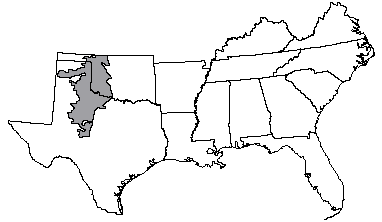
(From"Land Resource Regions and Major Land Resource Areas of the United States". United States Department of Agriculture Soil Conservation Service Handbook 296. Dec. 1981. page 53.)