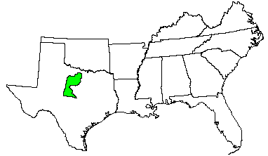
Land use: Nearly all this area is in ranches and farms. More than 80 percent is native range, pasture, or scrub oak forest. About 15 percent of the area is cropland. Most grassland is grazed by beef cattle. Some rangeland is also grazed by sheep and goats. Valleys, bottom land, and outwash areas of deep soils are farmed to wheat, oats, cotton, and grain sorghum. Hunting leases for deer, quail, and wild turkey are an important source of income in the area. The major concern of management is controlling woody brush that encroaches on the grassland.
Elevation and topography: Elevation ranges from 200 to 700 m. These dissected limestone, sandstone, and shale uplands have broad undulating divides and narrow steep-sided valleys. Only a few large, through-flowing streams have significant flood plains. Relief is mainly in meters, but the large valleys are tens of meters below the adjacent uplands.
Climate: Average annual precipitation-550 to 750 mm. Maximum precipitation is in spring and in fall. Summer moisture deficit ranges from 200 to 275 mm. Average annual temperature-18 to 19 C. Average freeze-free period-214 to 240 days.
Water: The moderate but somewhat erratic rainfall is the source of water for crops and range. Summer droughts are common. The larger rivers, such as the Brazos and Colorado Rivers, flow most of the year, but local streams flow intermittently. There are several large lakes and numerous flood-detention, reservoirs in the area. Some rural residents depend on community systems supplied from lakes for water; others depend on private lakes for water. Livestock water comes from streams or ponds. Ground water is scarce.
Soils: Most of the soils are Ustolls, Usterts, Ustalfs, and Ochrepts. These soils are well drained and moderately well drained, somewhat stony, and medium textured to fine textured. They have a thermic temperature regime, an ustic moisture regime, and mixed or montmorillonitic mineralogy. Very shallow to moderately deep Calciustolls (Talpa, Lueders, Kavett, Tarrant, and Valera series), Ustorthents (Yates series), and Argiustolls (Tarpley and Speck series) are on limestone plateaus or cuestas. Deep Chromusterts (Leeray series) and Haplustolls (Nukrum series) are in valleys at the base of cuesta scarps. Shallow and moderately deep Ustochrepts (Owens and Throck series) are on scarps and shaly uplands. Shallow to deep Haplustalfs (Callahan series), Rhodustalfs (Exray series), and Paleustalfs (Bonti and Truce series) are on hills and ridges and are underlain by interbedded sandstone and shale. Shallow Calciustolls (Cho and Mereta series) and deep Calciustolls (Nuvalde and Rowena series), Chromusterts (Reap series), and Pellusterts (Roscoe series) are on ancient alluvium and outwash. Paleustolls (Sagerton series), Paleustalfs (Winters and Wichita series), and Haplustalfs (Thurber series) are on outwash and stream terrace deposits. Deep Haplustolls (Elandco, Deleon, Frio, and Gowen series) and Ustifluvents (Bunyan, Yahola, Clairemont, and Lincoln series) are on younger stream deposits on flood plains.
Potential natural vegetation: This area supports savanna vegetation.
The Potential vegetation is rather uniform throughout the area despite the
wide variation in soils. Little bluestem, indiangrass, big bluestem, sideoats
grama, hairy grama, and Texas wintergrass are the dominant grass species.
Post oak and blackjack oak, sumacs, bumelias, and elm are the dominant woody
species. There also are numerous perennial forbs, including Maximilian sunflower,
heath aster, bushsunflower, and Engelmann-daisy.
(From "Land Resource Regions and Major Land Resource Areas of the United
States". United States Department of Agriculture Soil Conservation Service
Handbook 296. Dec. 1981. pages 54-55.)