Land use: Most of this area is range. Local tracts are cultivated, and a few are irrigated; the source of water is ground water and streams. The range is grazed by beef cattle, sheep, goats, and wildlife. Hay, pasture, and small grain for grazing are the principal crops. Pecan orchards are on flood plains. Irrigated cotton and grain sorghum are grown locally. Hunting leases for deer, quail, mourning dove, wild turkey, and javelina are an important source of income. The major concern of management is controlling brush that invades the grasslands.
Elevation and topography: Elevation ranges from 200 to 500 m on valley floors. On hills and in plateaus it ranges from 400 to 1,200 m, increasing gradually from east to west. Valleys are narrow to broad and have gently sloping to steep walls and smooth to undulating floors. Hills are sloping to very steep. Plateaus are broad and nearly level to undulating.
Climate: Average annual precipitation-375 to 750 mm. About three-fourths of the precipitation falls during the growing season. Average annual temperature-18 to 20 C. Average freeze-free period-230 to 270 days.
Water: In the western part rainfall is adequate for range grasses but inadequate for cultivated crops, and in the central and eastern parts rainfall is marginal for both. High temperatures and high evaporation and transpiration rates in summer limit crop production. Only a few rivers and streams flow throughout the year. Deep wells provide some water for irrigation and livestock and for domestic needs.
Soils: Most of the soils are Ustolls. They are stony and moderately fine textured and fine textured. These soils have a thermic temperature regime, an ustic moisture regime, and carbonatic or montmorillonitic mineralogy. Very shallow and shallow, gently sloping to sloping Calciustolls (Ector and Tarrant series) are on limestone hills. Shallow and moderately deep, nearly level to gently sloping Calciustolls (Kavett and Valera series) are on plateaus. Deep, nearly level Chromusterts (Tobosa and Anhalt series) occur on broad limy outwash plains and broad plateaus. Shallow, gently sloping to steep Ustochrepts (Brackett series) are on hills of marl and chalk. Haplustolls (Frio and Rioconcho series) are on the younger stream deposits of valley floors.
Potential natural vegetation: This area supports a plant community
ranging from desert shrub vegetation in the west to a mixed oak savanna with
tall and mid grasses in the east. Mid and short grasses and an abundance
of low-growing woody plants characterize the vegetation in the west. Oaks
in association with mid and tall grasses grow in the central and eastern
parts. The savanna ranges from nearly open grasslands with scattered trees
to oak stands interspersed with grasses. Forbs are in great abundance throughout
the Edwards Plateau.
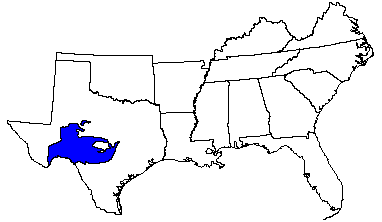
(From "Land Resource Regions and Major Land Resource Areas of the United
States". United States Department of Agriculture Soil Conservation Service
Handbook 296. Dec. 1981. page 56.)