Land use: Most of this area is in farms and ranches. About 85 percent is native grass pasture, improved grass pasture, or noncommercial oak forests that are used for grazing. Most of the pastureland, rangeland, and woodland is grazed by beef cattle, but dairy cattle are important in some places. In general, the acreage of cropland is decreasing, and that of improved pasture is increasing. About 14 percent of the area is farmed to peanuts, grain sorghum, small grains, or forage sorghum. Improved bermudagrass and other hay crops are important. Locally, peaches, apples, pecans, and vegetables are important crops. About 1 percent of the area is used for urban development and for other purposes.
Elevation and topography: Elevation is mainly 300 to 400 m, but along the Red River it is about 200 m. These uplands are nearly level to rolling and are moderately dissected. Land in the north has a higher average slope gradient and is gullied. Land in the south is nearly level to undulating and has been affected more by soil blowing. Stream valleys are narrow and have steep gradients. Local relief is mostly several meters.
Climate: Average annual precipitation - 625 to 875 mm, decreasing east to west. Maximum precipitation is in spring and in fall. Average precipitation during the frost-free period is about 500 to 600 mm. The summer moisture deficit ranges from about 175 to 250 mm. Average annual temperature - 17 to 19 C. Average freeze-free period - 225 to 240 days.
Water: The moderate and somewhat erratic rainfall is the source of water for pasture and crops. Shallow wells for supplemental irrigation are common in the south, but the availability and quantity of water varies greatly. Farm ponds are a major source of water for livestock. Local streams have intermittent flow. A few large reservoirs provide water for cities and towns and for recreation and irrigation. In most of the area, shallow wells supply water for domestic use, but ground water is scarce in places where sandstone and shale are near the surface.
Soils: Most of the soils are Ustalfs. They are well drained and moderately well drained, medium textured and coarse textured. These soils have a thermic temperature regime, an ustic moisture regime, and mixed or siliceous mineralogy. Deep, nearly level to undulating Paleustalfs (Windthorst, Duffau, Eufaula, and Konsil series) and nearly level to undulating, deep to moderately deep Haplustalfs (Chaney, Demona, Nimrod, Patilo, and Pedernales series) and deep, nearly level to undulating Haplustalfs (Cisco series) occur on uplands in the south. Ustifluvents (Bunyan, Energy, and Pulexas series) and Haplustolls (Elandco and Lamkin series) are on the narrow flood plains.
Potential natural vegetation: This area supports savanna vegetation. Tall grass is interspersed with trees and underbrush. Little bluestem, purpletop tridens, indiangrass, switchgrass, big bluestem, sand lovegrass, post oak, blackjack oak, elm, coralberry, greenbrier, and elbowbush are dominant species. Engelmann-daisy, Maxmilian sunflower, and trailing wildbean are among the numerous perennial forbs.
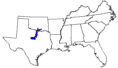
(From "Land Resource Regions and Major Land Resource Areas of the United States". United States Department of Agriculture Soil Conservation Service Handbook 296. Dec. 1981. pages 60-61.)