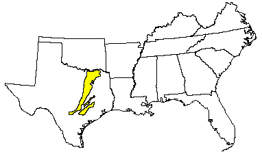
Land use: Nearly all this area is in farms, but urban development is increasing. About 40 percent of the area is cropland, about 45 percent improved pasture or rangeland, and the remainder urban areas or narrow strips of woodland along streams. Cotton and grain sorghum are the major cash crops. Other principal crops are small grain, corn, soybeans, and johnsongrass and other hay crops. Wheat and soybeans are important local crops in the north, and corn is an important crop in the south. Native pecan orchards are common along the flood plains. The present trend is toward a decrease in cropland on the more sloping and eroded soils and an increase in pasture. Beef cattle are the principal livestock.
Elevation and topography: Elevation ranges from 100 to 200 m, increasing gradually from south to north and from east to west. The area is mostly a nearly level to gently rolling dissected plain. Nearly level to gently sloping uplands merge into narrow valleys that have more sloping valley walls. Large rivers that cross the area have broad but shallow valleys. Significant tracts of hilly land are along the Austin chalk escarpment near the western side of the area. Relief is mainly from 1 to 10 m.
Climate: Average annual precipitation-750 to 1,150 mm. Maximum precipitation is in spring and in fall. Average precipitation during the frost-free period is about 600 to 650 mm. Average annual temperature-17 to 21 C. Average freeze-free period-230 to 280 days.
Water: In most years the moderate rainfall is adequate for crops and pastures, but summer droughts that reduce crop yields are common. The large rivers flow all years. Many large lakes and small flood-detention reservoirs provide municipal water supplies and recreation facilities and help to control flooding. Small farm ponds on individual farms are an important source of water for livestock. Ground water is scarce throughout the area, but in a few places small quantities of water are obtained from wells.
Soils: Most of the soils are Usterts, Ustolls, Aqualfs, and Ustalfs. They are well drained to somewhat poorly drained and medium textured to fine textured. These soils have a thermic temperature regime, an ustic or aquic moisture regime, and montmorillonitic, mixed, or carbonatic mineralogy. Moderately deep to deep, nearly level to gently sloping Pellusterts (Houston Black, Branyon, Dalco, Leson, and Burleson series) are on uplands, in valleys, and on stream terraces. Moderately deep to deep, gently sloping to sloping Chromusterts (Heiden, Ferris, and Vertel series) are on eroded uplands. Shallow to moderately deep, gently sloping to moderately steep Haplustrolls (Austin and Stephen series) and very shallow, gently sloping to moderately steep Ustorthents (Eddy series) are on uplands along the Austin chalk escarpment. Deep, nearly level to gently sloping Calciustolls (Lewisville and Venus series) and Haplustolls (Krum series) are in valleys and on stream terraces. Deep, nearly level to sloping Albaqualfs (Mabank series), Ochraqualfs (Wilson series), and Paleustalfs (Crockett series) are on uplands. Somewhat poorly drained Pelluderts (Trinity and Kaufman series), Haplaquolls (Tinn series), and moderately well drained Chromusterts (Ovan series) are on flood plains.
Potential natural vegetation: This area supports true prairie vegetation
in which little bluestem is dominant. Indiangrass, big bluestem, switchgrass,
and eastern gamagrass are major species. Many forbs grow in the area. Along
major rivers and tributaries, the plant community is a savanna. Oak, elm,
cottonwood, hackberry, and pecan produce a 30-percent canopy. Sedges, Virginia
and Canada wildrye, rustyseed paspalum, beaked panicum, switchgrass, indiangrass,
little and big bluestem, eastern gamagrass, and vine-mesquite are major
herbaceous species. Tickclover, trailing wildbean, lespedezas, and gay- feather
are common forbs.
(From "Land Resource Regions and Major Land Resource Areas of the United
States". United States Department of Agriculture Soil Conservation Service
Handbook 296. Dec. 1981. pages 62-63.)