Land Use and Land Cover for Oklahoma |
||
 |
 |
|
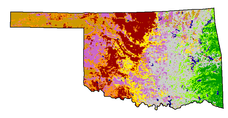
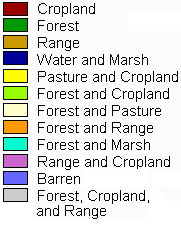
| See the landuse map for the entire
southern region for more information on
the source of data for this map.
|
||
Land Use and Land Cover for Oklahoma |
||
 |
 |
|
| See the landuse map for the entire
southern region for more information on
the source of data for this map.
|
||
 |
 |
Cropland
and Irrigated Cropland |
|---|---|---|
 |
Rangeland Pasture |
|
 |
Woodland | |
 |
Cities and
Towns |
|
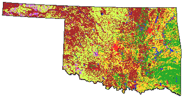
| Selected landuse classes for Oklahoma. Select the category
at the right for maps of specific categories.
|
||
 |
||
|---|---|---|
 |
Non-Irrigated Irrigated |
|
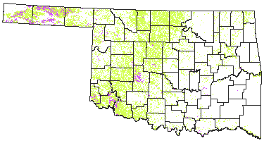
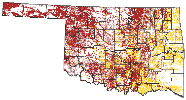
| Approximately 25.6% of the area of Oklahoma is cultivated.
The major portion of this land is in the western half of the state. Most
of that land (93% or 4,340,000 ha) is not irrigated. Only 7% or 314,000 ha
are irrigated. The irrigated land is located in the western panhandle and
in the far southwestern corner of the state.
|
||
 |
 |
Rangeland Pasture |
| Rangeland and pasture can be found thoughout Oklahoma. Rangeland
covers about 35% of the state or 6,350,000 hectares. Pasture makes up an
additional 16.5% or 2,986,000 hectares. These areas support a wide diversity
of wildlife and a large beef industry.
|
||

 |
 |
Wood Land |
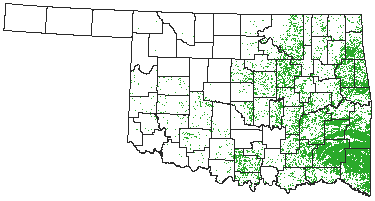
| Wooded areas dominate the south eastern portion of Oklahoma.
Here rainfall is at its maximum for the state. Woodland makes up 3,000,000
hectares or 16.6% of the state.
|
||
 |
 |
Cities and Towns |
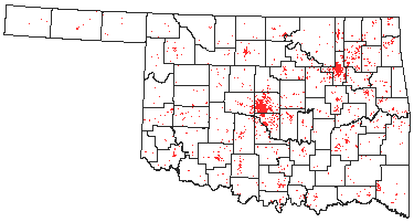
| Oklahoma contains many small towns throughout the state. The largest city and capitol, Oklahoma City, is centrally located in the state. The second largest city is Tulsa and is located in eastern Oklahoma. | ||